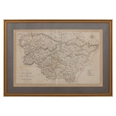
Items Similar to Essex John Cary 1787 Cary's New & Correct English Atlas 40cm 16" long gilt frame

Want more images or videos?
Request additional images or videos from the seller
1 of 8
Essex John Cary 1787 Cary's New & Correct English Atlas 40cm 16" long gilt frame
About the Item
Map of Essex by John Cary Engraver
London published as the act directs Sept 1st 1787 by J Cary Engraver Map & Printseller no 188 the corner of Arundel Street Strand
Antique engraved copperplate map with original outline colour
BIBLIOGRAPHY Cary's New & Correct English Atlas Published by John Cary, London
- Creator:John Cary (Maker)
- Dimensions:Height: 13.78 in (35 cm)Width: 15.75 in (40 cm)Depth: 0.79 in (2 cm)
- Style:Georgian (Of the Period)
- Materials and Techniques:
- Place of Origin:
- Period:
- Date of Manufacture:1787
- Condition:Wear consistent with age and use.
- Seller Location:BUNGAY, GB
- Reference Number:1stDibs: LU3867332644792

John Cary
John Cary was an English cartographer. He was born in February of 1755 and died in August of 1835. His career started with his apprenticeship in London, and he opened up his own shop in the Strand in 1783. His atlas New and Correct English Atlas became the standard reference work in England. He was commissioned in 1794 by the Postmaster General to survey England's roads. Out of this commission, he published Cary's New Itinerary in 1798. He later produced Ordnance Survey maps before 1805. His business was eventually taken over by G.F. Cruchley.
About the Seller
5.0
Vetted Seller
These experienced sellers undergo a comprehensive evaluation by our team of in-house experts.
Established in 1985
1stDibs seller since 2018
86 sales on 1stDibs
Typical response time: 10 hours
- ShippingRetrieving quote...Ships From: BUNGAY, United Kingdom
- Return PolicyA return for this item may be initiated within 7 days of delivery.
More From This SellerView All
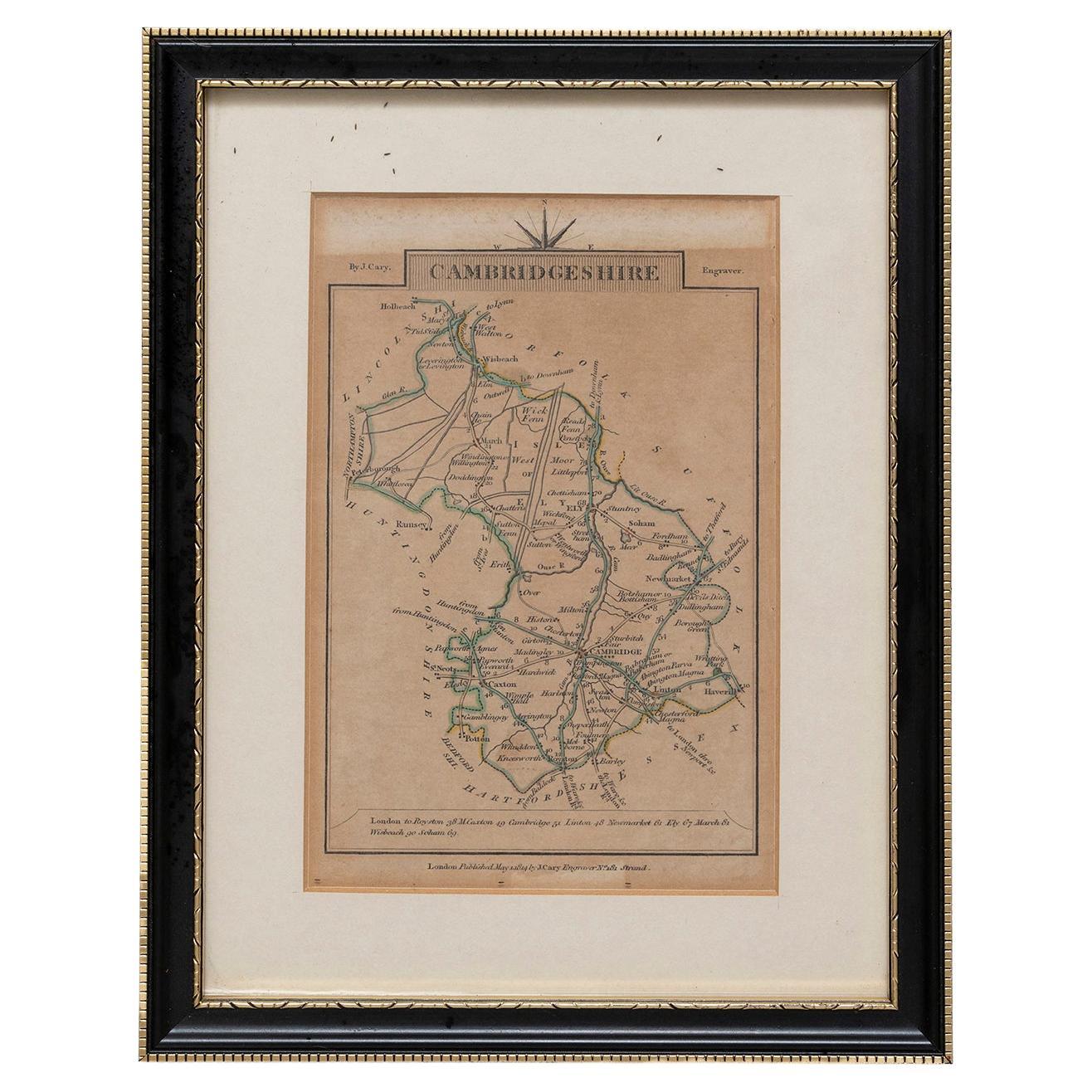
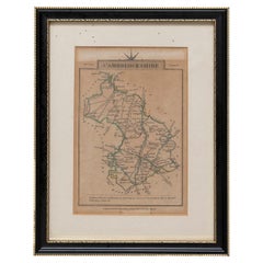
- Cambridgeshire J CaryBy John CaryLocated in BUNGAY, SUFFOLKCambridgeshire published may 1 1814 engraver no 181 strand Maker John Cary c. 1754 – 1835.Category
Antique 19th Century English Georgian Maps
MaterialsPaper
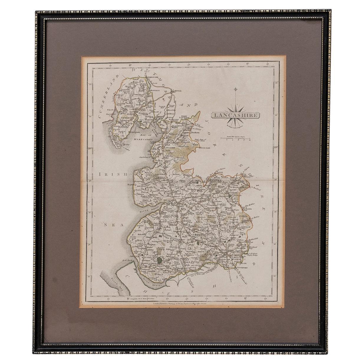
- Map Lancashire 1793 John Cary engraver 37cm 14 1/2" highLocated in BUNGAY, SUFFOLKMap of Lancashire by John Cary engraver published 1st Jan 1793 by J Cary Engraver & Mapseller Strand in original black and gold classic map frameCategory
Antique 18th Century English Georgian Maps
MaterialsPaper
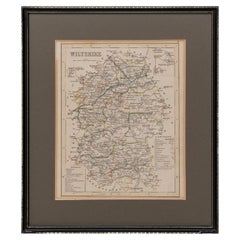
- Map Wiltshire Joshua Archer Pentonville London framed 35cm 14" highLocated in BUNGAY, SUFFOLKMap of Wiltshire Drawn & Engraved by Joshua Archer Pentonville London Window Parts of Wiltshire in Berkshire Explanation of Salisbury County DivisionsCategory
Antique 19th Century English Georgian Maps
MaterialsPaper
- Road Map Britannia No 15 London to St Davids John Ogilby Brown Gilt FrameBy John OgilbyLocated in BUNGAY, SUFFOLKThe continuation of the road from London to St Davids, commencing at Abingdon Com Berks and extending to Monmouth By John Ogilby Esq, His Majesties Cosmographer. From Abingdon to Farringdon, to Lechlade, to Fairford, to Barnsley to Gloucester showing Monmouth as the destination. A road map from Britannia, 1675/6. No 15. Hand coloured and floated on a cream mount within a brown painted and gilded ogee frame. Some foxing and creasing, uneven edge of sheet, all commensurate with age Provenance : purchased as pair from a collector with no 25 London to Lands End. Framed as a pair. Sheet width 46.5cm., 18 ¼ ”., height 37.5cm., 14 ¾ “ Frame width 66.5cm., 26”., height 56cm., 22 ” In a remarkable life John Ogilby pursued, several careers, each ending in misfortune, and yet he always emerged undeterred, to carry on. His modern reputation is based on his final career, started in his sixty-sixth year, as a publisher of maps and geographical accounts. Ogilby was born outside Dundee, in 1600, the son of a Scottish gentleman. While he was still a child, the family moved to London. When the elder Ogilby was imprisoned for debt, the young John invested his savings in a lottery, won a minor prize, and settled his father's debts. Unfortunately, not enough money was left to secure John a good apprenticeship; instead, he was apprenticed to a dance master. Ogilby was soon dancing in masques at court but, one day, while executing a particularly ambitious leap, he landed badly. The accident left him with a permanent limp, and ended his dancing career. However, he had come to the attention of Thomas Wentworth, later Earl of Strafford, Charles I's most senior minister. Ever one to exploit his contacts, Ogilby became a dance instructor in Strafford's household. When Strafford was sent to Ireland, Ogilby accompanied him as Deputy-Master of the Kings Revels, and then Master of Revels. In Dublin, he built the New Theatre, in St. Werburgh Street, which prospered at first, but the Irish Rebellion, in 1641, cost Ogilby his fortune, which he estimated at £2,000, and almost his life. After brief service as a soldier, he returned to England, survived shipwreck on the way, and arrived back penniless. On his return, Ogilby turned his attention to the Latin classics, as a translator and publisher. His first faltering attempt, in 1649, was a translation of the works of Virgil, but after his marriage to a wealthy widow the same year, his publishing activities received a considerable boost. One means by which Ogilby financed these volumes was by subscription, securing advance payments from his patrons, in return for including their name and coats-of-arms on the plates of illustrations. Another approach was to secure a patron, preferably in the court circle. Ogilby's first patron was Strafford, who found out too late that all leading ministers are dispensable when Charles I assented to his execution in 1641. As he re-established himself, Ogilby sought a new patron, the King himself. In 1661, Ogilby was approached to write poetry for Charles II's coronation procession; he later published 'The Relation of His Majesties Entertainment Passing Through the City of London', and a much enlarged edition the following year, which included a fine set of plates depicting the procession. Royal favour was bestowed in 1674 when John Ogilby received the title of 'His Majesty's Cosmographer and Geographick Printer' with a salary of £13.6s.8d per annum. In 1665, Ogilby left London to avoid the Plague then ravaging the capital. The following year, in the Great Fire of London, Ogilby claimed that he lost his entire stock of books valued at some £3,000, as well as his shop and house, leaving him worth just £5. As he sought to restore his fortunes, Ogilby was already looking in new directions. The initial opportunity he seized on was the reconstruction of London's burnt-out centre. He secured appointment as a "sworn viewer", whose duty was to establish the property boundaries as they existed before the Fire. Ogilby was assisted in the project by his step-grandson, William Morgan...Category
Antique Late 17th Century British Charles II Maps
MaterialsPaper
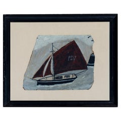
- Painting Oil Naive Cutter Boat Spirit Alfred Wallis Oil Length 40cm 16"Located in BUNGAY, SUFFOLKCutter pz17 in full sail past a lighthouse Board length 24cm., 9 1/2", height 21cm., 8 1/4" Floated on a cream mount in a recycled black moulded frame with some losses Length 40cm.,...Category
21st Century and Contemporary English Mid-Century Modern Paintings
MaterialsPaint
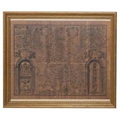
- Buckingham Both Shyre and Shire John Speed 1610 Gilded FrameLocated in BUNGAY, SUFFOLKJust purchased more information to follow. In unrestored condition, the sheet can be cleaned.Category
Antique 17th Century English Baroque Maps
MaterialsPaper

You May Also Like
- 18-inch Globe, Cary's, London, 1840By Cary’sLocated in Milano, ITJohn and William Cary Updated by George and John Cary Terrestrial Globe London, 1840 lb 22 (kg 10) Slight surface abrasions due to use. A small crack on the horizon circle. The globe rests in its original Dutch style stand with four supporting turned wood columns. It measures 26 in in height x 23.6 in in diameter with the diameter of the sphere measuring 18 in; 66 cm in height x 60 cm in diameter with the diameter of the sphere measuring 45.72 cm. The 18 inch...Category
Antique 1840s English Early Victorian Globes
MaterialsWood, Paper
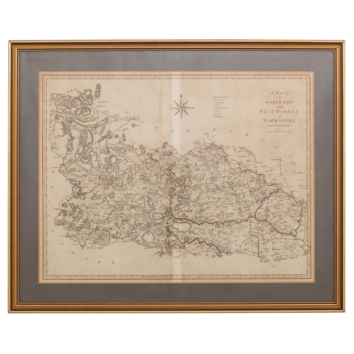
- 19th Century John Cary Map of North Part of West Riding of Yorkshire, C.1805By John CaryLocated in Royal Tunbridge Wells, KentAntique 19th century British original John Cary sr (1755-1835) map of North part of the West Riding of Yorkshire, From the beft Authorities. Engraved J Car...Category
Antique 19th Century British Maps
MaterialsPaper
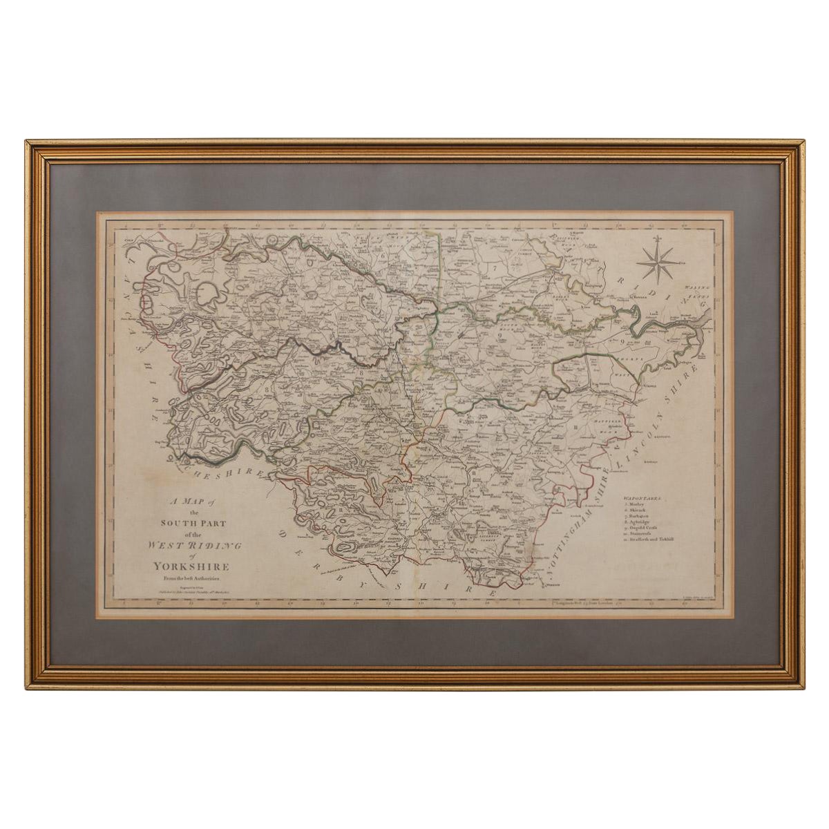
- 19th Century John Cary Map of South Part of West Riding of Yorkshire, circa 1805By John CaryLocated in Royal Tunbridge Wells, KentAntique 19th century British original John Cary sr (1755-1835) map of South part of the West Riding of Yorkshire, From the beft Authorities. Engraved J Car...Category
Antique 19th Century British Maps
MaterialsPaper
- Antique Map of Bavaria and Salzburg by Cary, 1811By John CaryLocated in Langweer, NLAntique map titled 'A New Map of the Circle of Bavaria'. Antique map of Bavaria and Salzburg, Germany. Covers the Duchy of Bavaria and the mountainous A...Category
Antique Early 19th Century Maps
MaterialsPaper
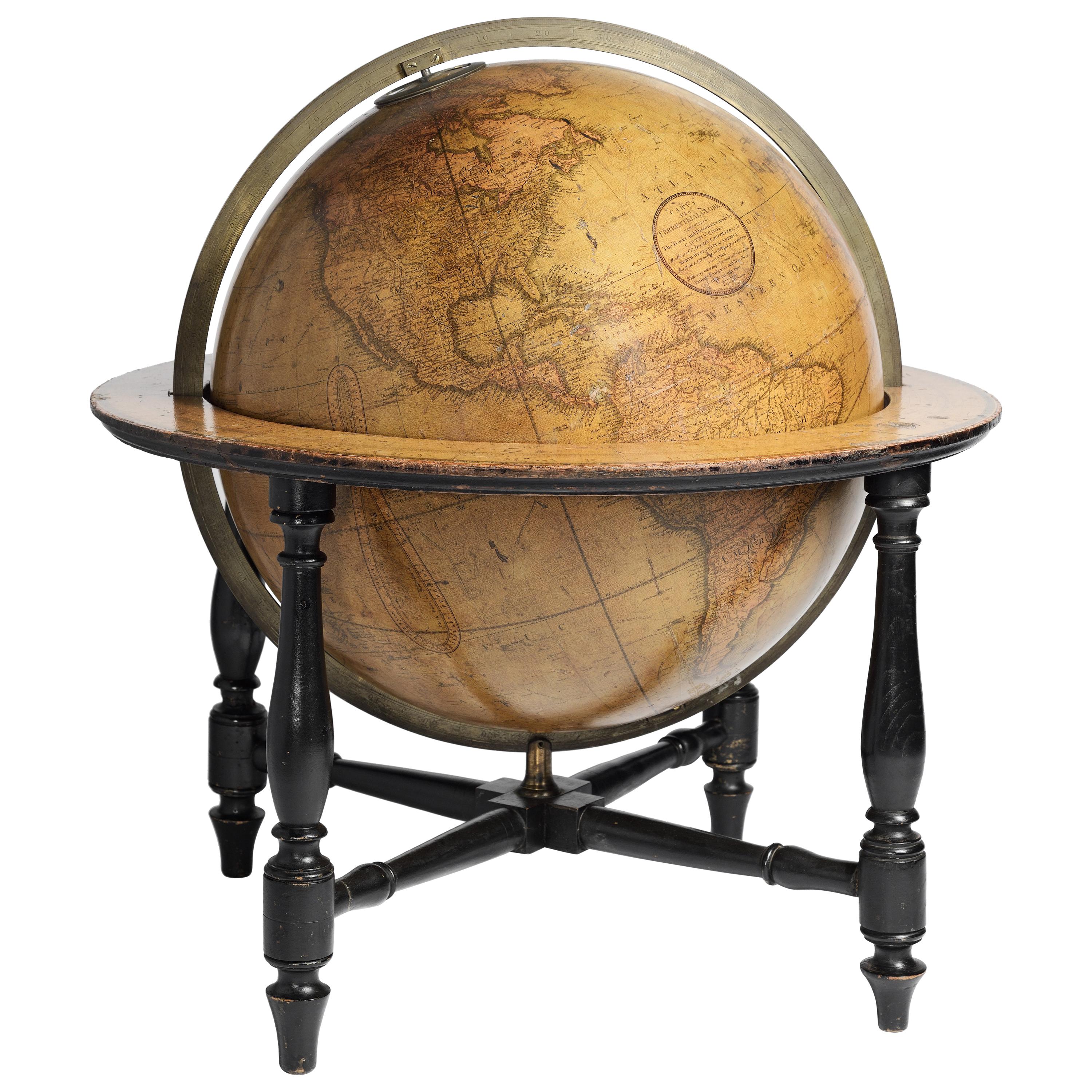
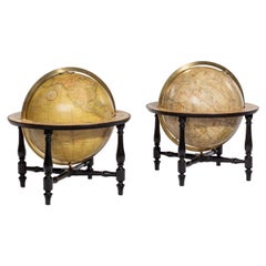
- Pair of Cary’s Table GlobesLocated in Lymington, HampshireA pair of Cary’s 15-inch table globes, each set into an ebony stand with four turned legs and stretchers, the terrestrial stating “Cary’s New Terrestrial Globe exhibiting the tracks ...Category
Antique Early 1800s English Globes
MaterialsEbony
- Antique Map of the Upper and Lower Rhine by Cary '1811'By John CaryLocated in Langweer, NLAntique map titled 'A New Map of the Circles of the Upper and Lower Rhine'. Antique map covering an area from Westphalia and Lower Saxony in the north to France and Swabia in the south.Category
Antique Early 19th Century Maps
MaterialsPaper


Recently Viewed
View AllMore Ways To Browse
Antique Long Johns
Gilt English Frame
Essex Antique
Gilt Georgian Frame
Antique Furniture Essex
Cary Of London
Antique Maps Essex
Map Of Essex
Victorian Staircase
Antique Great Lakes Map
Antique Map Chile
Antique Map Of Jerusalem
Burgundy Map
Macedonia Map
Map Of Hungary
Maps Of Ireland 18th Century
Oceanic Wood Carving
Wood Carving Ocean