Paper More Furniture and Collectibles

364
10,852
938
697
to
1,497
8,246
4,179
12,487
12,446
12,471
396
254
162
107
105
85
64
35
28
26
24
18
13
7
6
5
5
3
3,302
2,963
4,587
1,635
838
1,211
1,590
156
73
227
195
131
286
398
384
402
457
19,116
18,946
12,747
12,487
6,513
2,966
2,276
2,180
1,219
692
139
104
79
63
60
Material: Paper
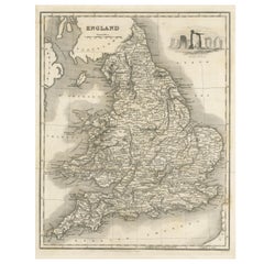
Antique Map of England with Vignette of Stonehenge
Located in Langweer, NL
Antique map titled 'England'. Original antique map of England, with decorative vignette of stonehenge. Engraved by R. Scott. Published by Fulla...
Category

Mid-19th Century Antique Paper More Furniture and Collectibles

Materials

Paper

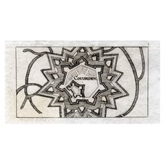
Antique Map of Coevorden in the Netherlands, 1691
Located in Langweer, NL
Plate 'Covorden.' (Plan of the fortified city of Coevorden, The Netherlands.) This attractive original old antique print / plate originates from: 'Ausführliche und grundrichtige Besc...
Category

17th Century Antique Paper More Furniture and Collectibles

Materials

Paper

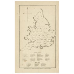
Antique Map of England and Wales with Roman Numerals
Located in Langweer, NL
Untitled original antique map of England and Wales. Drawn & Engraved for Cobbetts 'Geographical Dictionary of England & Wales'. Published by William Cobbett, 1832.
Category

Mid-19th Century Antique Paper More Furniture and Collectibles

Materials

Paper

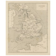
Steel Engraved Map of Ancient Britain
Located in Langweer, NL
Antique map titled 'Angleterre Ancienne'. Original old map of Ancient Britain. Source unknown, to be determined. Published circa 1880.
Category

Late 19th Century Antique Paper More Furniture and Collectibles

Materials

Paper

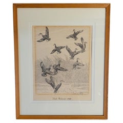
Rare Lynn Bogue Hunt Engraving of Ducks Unlimited, 1940
By Lynn Bogue Hunt
Located in Dallas, TX
Presenting a Rare Lynn Bogue Hunt engraving of ducks unlimited 1940. This piece cam from a wealthy estate in Dallas, TX with the mansion being built...
Category

Mid-20th Century American Sporting Art Paper More Furniture and Collectibles

Materials

Paper

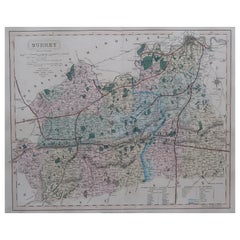
Original Antique English County Map - Surrey. J & C Walker. 1851
Located in St Annes, Lancashire
Great map of Surrey Original colour By J & C Walker Published by Longman, Rees, Orme, Brown & Co. 1851 Unframed.
Category

1850s English Other Antique Paper More Furniture and Collectibles

Materials

Paper

Large Antique County Map of Cambridgeshire, England
Located in Langweer, NL
Antique map titled 'A Map of Cambridgeshire from the best Authorities'. Original old county map of Cambridgeshire, England. Engraved by John Cary. Originates from 'New British Atlas'...
Category

Early 19th Century Antique Paper More Furniture and Collectibles

Materials

Paper

Pair of White Satin Lacquer Dressers with Parchment Drawers by Juan Montoya
Located in New York, NY
Beautiful pair of white satin lacquered dressers by Juan Montoya. Unique design with reeded panels and six partchment drawers with a bronze handle. Property from esteemed interio...
Category

21st Century and Contemporary American Mid-Century Modern Paper More Furniture and Collectibles

Materials

Bronze

Original Copper Engraved Map of France
Located in Langweer, NL
Antique map titled 'New and Accurate Map of France from the latest improvements'. Original copper engraved map of France. Engraved by T. Bowen, published circa 1771.
Category

Late 18th Century Antique Paper More Furniture and Collectibles

Materials

Paper

Antique Map of the British Isles According to the Geography of the Roman Empire
Located in Langweer, NL
Antique map titled 'Insulae Britannicae'. Interesting map of Britain, Scotland, and Ireland. It shows a rudimentary outline of the islands according to the geography of the Roman Emp...
Category

Late 18th Century Antique Paper More Furniture and Collectibles

Materials

Paper

Rolfe's Angling Sketches, Fishing Picture, Not Long Caught.
Located in Oxfordshire, GB
Rolfe's Angling Sketches. An extremely rare colourful fishing lithograph after Henry Leonidas Rolfe (1823 - 1881) 'Rolfe's Angling Sketches, Not ...
Category

1850s British Sporting Art Antique Paper More Furniture and Collectibles

Materials

Paper

Moderno, Design for Living in Brazil, Mexico, and Venezuela, 1940-1978
Located in New York, NY
Catalog of a traveling exhibition opening at the America’s Society in New York in 2015. Published by Santillana. 4to, hardcover, 280 pages, with both full color and b/w illustrations, including a section of plates dedicated to the exhibit. With incisive essays by Gabriela Rangel, Jorge Rivas Perez, Lourdes Blanco, Ana Elena Mallet, Christina L. De Leon, Maria Cecilia Loschiavo Dos Santos, and Luis Canstaneda, along with historical texts by Clara Porset, Lina Bo Bardi and others, plus designer biographies. An important contribution to the understanding of Latin American postwar modernism...
Category

2010s Mexican Mid-Century Modern Paper More Furniture and Collectibles

Materials

Paper

Antique Map of the Vitim and Lena Rivers, Russia, 1768
Located in Langweer, NL
Antique map titled 'Carte du District de Witim et Phénomene (..)'. Map of the confluence of the Vitim and Lena rivers, and an illustration of atmospheric phenomena. This print origin...
Category

18th Century Antique Paper More Furniture and Collectibles

Materials

Paper

Antique Map of France with Decorative Title Cartouche
Located in Langweer, NL
Antique map titled 'Carte de la France'. Original old map of France. This map originates from 'Le Petit Atlas Maritime Recueil De Cartes et Plans Des Quatre Parties Du Monde (..) by ...
Category

Mid-18th Century Antique Paper More Furniture and Collectibles

Materials

Paper

Antique Map of Guyenne, Gascony and Béarn, France
Located in Langweer, NL
Antique map titled 'Guyenne et Gascogne et Bearn'. Original old map of Guyenne (or Guienne), Gascony and Béarn, France. This map originates from 'Le Petit Atlas Maritime Recueil De C...
Category

Mid-18th Century Antique Paper More Furniture and Collectibles

Materials

Paper

Antique Map of New Ireland with 7 Coastal Profiles
Located in Langweer, NL
Antique print titled 'l'Isle St. Jean (..) - Cap St. George (..)'. Antique map of New Ireland, an island in the Bismarck Archipelago, New Guinea. Lying just north of New Britain, fro...
Category

Late 18th Century Antique Paper More Furniture and Collectibles

Materials

Paper

Antique Religious Book Sculptural Artwork, circa 1950
Located in Barcelona, Barcelona
Antique religious book artwork consisting of two books tied together by a thread. Two volumes of the Roman Missal published in Catalan by an Unknown ed...
Category

1950s Spanish Modern Vintage Paper More Furniture and Collectibles

Materials

Paper

Mallett Catalog 2005, 1st Ed
Located in valatie, NY
Mallett Catalog 2005. 1st Ed softcover catalog illustrated in color with all the objects fully described. Typical Mallett catalog showcasing important furniture, porcelain etc. Alway...
Category

21st Century and Contemporary English Paper More Furniture and Collectibles

Materials

Paper

Mallett Catalog 1997, 1st Ed
Located in valatie, NY
Mallett catalog from 1997. Softcover catalog photographed in color with all the objects fully described. Typical Mallett catalog of important furniture, porcelain etc. Always a great...
Category

21st Century and Contemporary English Paper More Furniture and Collectibles

Materials

Paper

1876 "Gettysburg, The Repulse of Longstreet's Assault." Engraving
Located in Colorado Springs, CO
Presented here is an 1876 engraving of John B. Bachelder and James Walker’s Gettysburg. The Repulse of Longstreet’s Assault. The engraved scene depicts the decisive battle on the final day of the Battle of Gettysburg. Researched by the photographer and topographer John B. Bachelder and painted by James Walker, the original painting was created in 1870. This detailed engraving was done by H. B. Hall Jr. and published by James Drummond Ball. Otherwise called Pickett’s Charge, the battle occurred on July 3, 1863. Pickett’s corp commander, Lieutenant General James Longstreet was placed in charge of the attack despite his hesitations. Longstreet’s central role led to the title of the work, Repulse of Longstreet’s Assault. In an attempt to gain control of an important supply route, nine Confederate brigades charged across three-quarters of a mile of open ground against cannon fire to take Cemetery Ridge from the defending Union Army. Despite their overwhelming numbers, the Confederate forces were repelled with considerable casualties marking not only a decisive victory for the Union, but also the beginning of the slow defeat of Lee’s Army. The furthest the charging forces advanced before being repulsed would forever be known as the “High Water Mark of the Confederacy.” The Confederate army never recovered from the losses at Gettysburg and it effectively ended Lee’s campaign into Pennsylvania. The engraving gives the perspective from the Union rear, one that encompasses most of the battlefield, from Big Round Top on the left to the northern reaches of Cemetery Ridge on the right. The Confederate lines at Seminary Ridge are in the far distance, partially obscured by bursting shells. The image centers on the main Confederate assault, in the vicinity of what today are known as "The Copse" and "The Bloody Angle." The composition has elemen...
Category

1870s American Antique Paper More Furniture and Collectibles

Materials

Paper

Antique Map of the Region of Berre-l'Étang, France
Located in Langweer, NL
Antique map titled 'Carte des etangs de Berre de Martigue et environs'. Original map of the region of Berre-l'Étang, France. This map originates from 'Le Petit Atlas Maritime (..)' b...
Category

Mid-18th Century Antique Paper More Furniture and Collectibles

Materials

Paper

Antique Map of the Languedoc Canal, Between Touloouse and Marseillette, France
Located in Langweer, NL
Antique map titled 'Carte du canal de Languedoc depuis Toulouse jusqu'a I'etang de Marceillette'. Original old map of the Languedoc Canal, between Touloouse and Marseillette, France....
Category

Mid-18th Century Antique Paper More Furniture and Collectibles

Materials

Paper

Antique Map of the Region of Martigues, France
Located in Langweer, NL
Title: "Etang de Martigues et Environs: Antique Map of the Martigues Region, France" Description: This antique map, titled "Etang de Martigue et Environs," offers a detailed view of...
Category

Mid-18th Century Antique Paper More Furniture and Collectibles

Materials

Paper

Antique Map of the Admiralty Islands, Bismarck Archipelago
Located in Langweer, NL
Antique map titled 'Trois Vues des Isles de l'Amirauté'. Several coastal views of the Admiralty Islands, Bismarck Archipelago, to the north of New Guinea in the South Pacific Ocean. ...
Category

Late 18th Century Antique Paper More Furniture and Collectibles

Materials

Paper

Original Antique Map of Turkey, Asia Minor and Cyprus
Located in Langweer, NL
Antique map titled 'Natoliae sive Asia Minor'. Original old map of Turkey, Asia Minor and Cyprus. Includes a decorative cartouches, sailing ship, sea mon...
Category

Early 17th Century Antique Paper More Furniture and Collectibles

Materials

Paper

Antique Map of the Santa Cruz Islands with Inset of Carteret and Gower Islands
Located in Langweer, NL
Antique map titled 'Isles de la Reine Charlotte (..)'. A detailed chart of the Santa Cruz islands, to the north of the New Hebrides, with Carteret's track in "Swallow"; including an ...
Category

Late 18th Century Antique Paper More Furniture and Collectibles

Materials

Paper

Large Antique County Map of Wiltshire, England, 1805
Located in Langweer, NL
Antique map titled 'A Map of Wiltshire from the best Authorities'. Original old county map of Wiltshire, England. Engraved by John Cary. Originates from 'New British Atlas' by John S...
Category

Early 19th Century Antique Paper More Furniture and Collectibles

Materials

Paper

“Spoon” Industrial Design Steel Covered Book, Phaidon Press – 1st Edition
Located in Philadelphia, PA
“Spoon” Designed by Mark Diaper, Phaidon Press, 1st Edition 2002 This is the out of print polymer coated Steel version with a cover bent like the silhouette of a spoon. An award winning catalogue showcasing 100 contemporary industrial designers nominated by 10 curators. Spoon covers a vast spectrum of styles, media and work, from kitchen utensils, tools and lighting, to furniture, high-tech products and cars. Each designer is featured over two double-page spreads, illustrated with sketches, models and photographs. A short explanatory text by the selecting curator, and biographical information on the designer are provided. Each curator has also chosen a design ‘classic’ that illustrates the concept of ‘good design’. Publisher ‏ : ‎ Phaidon Press; 1st Printing Edition – September 20, 2002 Hardcover ‏ : ‎ 444 pages ISBN-10 ‏ : ‎ 0714842516 Item Weight ‏ : ‎ 1.1 pounds Dimensions ‏ : ‎ 8.5 in W x 1 in. H x 12 in. L The expected light wear found in used books.
Category

Early 2000s American Industrial Paper More Furniture and Collectibles

Materials

Metal

Large Antique County Map of Leicestershire, England, 1805
Located in Langweer, NL
Explore Leicestershire's Past: Antique Map by John Cary Step into the history of Leicestershire, England, with this original old county map engraved by the renowned cartographer Joh...
Category

Early 19th Century Antique Paper More Furniture and Collectibles

Materials

Paper

Small Antique Map of England and Wales as It Was During the Heptarchy
Located in Langweer, NL
Antique map titled 'La Britannique dans sa Heptarchie Anglois Saxonique'. This little map shows England and Wales as it was during the Heptarchy, a phrase referring to the seven king...
Category

Mid-18th Century Antique Paper More Furniture and Collectibles

Materials

Paper

Antique Map of the Coast of France Between Brest and Bayonne
Located in Langweer, NL
Antique map titled 'Carte des Costes de France depuis Brest jusquá Bayone'. Original old map of the coast of France between Brest and Bayonne. This map originates from 'Le Petit Atla...
Category

Mid-18th Century Antique Paper More Furniture and Collectibles

Materials

Paper

Beautiful Homes and Gardens in California
Located in New York, NY
Important and lavishly produced survey of postwar California domestic architecture, written by Frank Lloyd Wright-trained California architect Herbert Weisskamp and published by Abrams in 1964. First edition, oblong 4to (10.25” x 7.25”) hardcover with pictorial dust jacket, 4 full color photos, 314 black-and-white photos (3/4 of them by Julius Schulman), plus 113 b/w plans, drawings, and elevations. Showcases the work of the following architects and landscape designers: Raphael Soriano, Pierre Koenig, Craig Ellwood, Frank Lloyd Wright, Mark Mills, Aaron Green...
Category

1960s American Mid-Century Modern Vintage Paper More Furniture and Collectibles

Materials

Paper

E.T. the Extra Terrestrial
Located in London, GB
Original US Limited-Edition Bottleneck Gallery Variant Print from 2017 number 153/225 This poster has been hand signed by Dee Wallace, "Mary Taylor" He...
Category

2010s American Paper More Furniture and Collectibles

Materials

Paper

Antique Map of Harlingen, Harbour City in the Netherlands, 1691
Located in Langweer, NL
Plate 'Harlingen.' (Plan of the city of Harlingen, The Netherlands.) This attractive original old antique print / plate originates from: 'Ausführliche und grundrichtige Beschreibung ...
Category

17th Century Antique Paper More Furniture and Collectibles

Materials

Paper

Original Italian Antique Map of Asia Minor and Cyprus and Neighboring Regions
Located in Langweer, NL
Antique map titled 'Natolia detta anticamente Asia Minor (..)'. Rare map of Asia Minor (Turkey) and Cyprus and neighboring regions. The map provides one of the most detailed and up t...
Category

Late 17th Century Antique Paper More Furniture and Collectibles

Materials

Paper

Small Steel Engraved Map of England
Located in Langweer, NL
Antique map titled 'England'. Original steel engraved map of England. Drawn by A. Arrowsmith, engraved by S. Hall. Published 1829 by Longman & Co, London.
Category

Mid-19th Century Antique Paper More Furniture and Collectibles

Materials

Paper

Large Antique County Map of Suffolk, England
Located in Langweer, NL
Antique map titled 'A Map of Suffolk from the best Authorities'. Original old county map of Suffolk, England. Engraved by John Cary. Originates from 'New British Atlas' by John Stock...
Category

Early 19th Century Antique Paper More Furniture and Collectibles

Materials

Paper

Antique Map of England with Contemporary Hand Coloring
Located in Langweer, NL
Antique map titled 'l'Angleterre'. Original antique map of England, with original/contemporary hand coloring. Published by Crepy, circa 1767.
Category

Late 18th Century Antique Paper More Furniture and Collectibles

Materials

Paper

Japanese Four Panel Paper Screen
Located in Essex, MA
Pair of two panel screens with a rooster and a hen in amongst bamboo. Signed by the artist Ema Saiko 1787-1861. A Japanese painter, poet and calligrapher celebrated for her Chinese...
Category

1850s Japanese Antique Paper More Furniture and Collectibles

Materials

Paper

Large Antique County Map of Essex, England
Located in Langweer, NL
Antique map titled 'A Map of Essex from the best Authorities'. Original old county map of Essex, England. Engraved by John Cary. Originates from 'New Brit...
Category

Early 19th Century Antique Paper More Furniture and Collectibles

Materials

Paper

Antique Japanese Kano School Painting by Yosenin Korenobu
Located in Prahran, Victoria
Six-panel Kano School tiger screen by Yosenin Korenobu (1753-1808). Sumi-e ink on paper, late 18th century. Dimensions: H 169cm x W 382cm.
Category

Late 18th Century Japanese Edo Antique Paper More Furniture and Collectibles

Materials

Wood, Paper

Five Beautiful Women Hardcover by Victor Skrebneski Book 1987 1st Edition
Located in North Hollywood, CA
Five Beautiful Women Hardcover – February 19, 2008 by Victor Skrebneski (Author), Hubert de Givenchy (Introduction). Victor Skrebneski is celebrated as one of the world’s finest fashion and portrait photographers. His diverse body of work has won him international accolades and, for more than half a century, he has photographed the world’s most famous people, from Orson Welles, Truman Capote, and Audrey Hepburn to Andy Warhol, David Bowie, and Iman. In 1962, Skrebneski became the exclusive photographer for Estée Lauder, and over the years his flawless images of models such as Paulina Porizkova...
Category

Late 20th Century American Post-Modern Paper More Furniture and Collectibles

Materials

Paper

Antique Map of Deventer in the Netherlands, 1691
Located in Langweer, NL
Plate 'Devendr.' (Plan of the fortified city of Deventer, The Netherlands.) This attractive original old antique print / plate originates from: 'Aus...
Category

17th Century Antique Paper More Furniture and Collectibles

Materials

Paper

Large Antique County Map of Surrey, England
Located in Langweer, NL
Antique map titled 'A Map of Surry from the best Authorities'. Original old county map of Surrey, England. Engraved by John Cary. Originates from 'New British Atlas' by John Stockdal...
Category

Early 19th Century Antique Paper More Furniture and Collectibles

Materials

Paper

Original Antique Map of England and Wales, with Decorative Cartouche
Located in Langweer, NL
Antique map titled 'England and Wales from the best Authorities'. Original antique map of England and Wales, with decorative cartouche. Engraved by T. Conder. Published circa 1790.
Category

Late 18th Century Antique Paper More Furniture and Collectibles

Materials

Paper

Food of France by Kay Halsey and Lulu Grimes Hardcover Book
Located in North Hollywood, CA
The Food of France by Kay Halsey and Lulu Grimes hardcover cook book. (Part of the A Journey for Food Lovers Series)by Maria Villegas and Sarah Randell Title: The Food of France Publisher: Whitecap Books Publication Date: 2001 Binding: Hardcover Condition: Good Dust Jacket Condition: Good. Synopsis: When one thinks of great food, one invariably thinks of France. After all, this is the birthplace of some of the world's greatest chefs, such as Auguste D'Escoffier, and a major influence on many others, such as Julia Child. THE FOOD OF FRANCE is the second in a series of richly photographed cookbooks that examines the food of different countries. Lush images and information on France and its internationally renowned gastronomic culture make this book much more than a cookbook. Pictorial essays presented in gatefold spreads highlight food journeys that share the traditions behind France's best-known exports, including cheese and pastries. A glossary of French food...
Category

21st Century and Contemporary French French Provincial Paper More Furniture and Collectibles

Materials

Paper

Large Antique County Map of Warwickshire, England
Located in Langweer, NL
Antique map titled 'A Map of Warwickshire from the best Authorities'. Original old county map of Warwickshire, England. Engraved by John Cary. Originates from 'New British Atlas' by ...
Category

Early 19th Century Antique Paper More Furniture and Collectibles

Materials

Paper

Antique Plan of the Region of Cassis, France
Located in Langweer, NL
Antique map titled 'Plan de Cassis et environs'. Original plan of the region of Cassis, France. This map originates from 'Le Petit Atlas Maritime (..)' by J.N. Bellin. Published 1764...
Category

Mid-18th Century Antique Paper More Furniture and Collectibles

Materials

Paper

Antique Religious Book Sculptural Artwork, circa 1950
Located in Barcelona, Barcelona
Antique religious book artwork consisting of two books tied together by a thread. Two volumes of the Roman Missal published in Catalan by an Unknown ed...
Category

1950s Spanish Modern Vintage Paper More Furniture and Collectibles

Materials

Paper

Original Antique English County Map, Lincolnshire, J & C Walker, 1851
Located in St Annes, Lancashire
Great map of Lincolnshire Original colour By J & C Walker Published by Longman, Rees, Orme, Brown & Co. 1851 Unframed.
Category

1850s English Other Antique Paper More Furniture and Collectibles

Materials

Paper

Large Antique County Map of North Wales, England
Located in Langweer, NL
Antique map titled 'A Map of North Wales from the best Authorities'. Original old county map of North Wales, England. Engraved by John Cary. Originates from 'New British Atlas' by Jo...
Category

Early 19th Century Antique Paper More Furniture and Collectibles

Materials

Paper

Large Antique County Map of Nottinghamshire, England
Located in Langweer, NL
Antique map titled 'A Map of Nottinghamshire from the best Authorities'. Original old county map of Nottinghamshire, England. Engraved by John Cary. Originates from 'New British Atla...
Category

Early 19th Century Antique Paper More Furniture and Collectibles

Materials

Paper

Large Antique County Map of South Wales, England
Located in Langweer, NL
Antique map titled 'A Map of South Wales from the best Authorities'. Original old county map of South Wales, England. Engraved by John Cary. Originates from 'New British Atlas' by Jo...
Category

Early 19th Century Antique Paper More Furniture and Collectibles

Materials

Paper

Large Antique County Map of Northumberland, England
Located in Langweer, NL
Antique map titled 'A Map of Northumberland from the best Authorities'. Original old county map of Northumberland, England. Engraved by John Cary. Originates from 'New British Atlas'...
Category

Early 19th Century Antique Paper More Furniture and Collectibles

Materials

Paper

Large Antique County Map of Buckinghamshire, England
Located in Langweer, NL
Antique map titled 'A Map of Buckinghamshire from the best Authorities'. Original old county map of Buckinghamshire, England. Engraved by John Cary. Originates from 'New British Atla...
Category

Early 19th Century Antique Paper More Furniture and Collectibles

Materials

Paper

Antique Map of England and Wales, with References to the Counties
Located in Langweer, NL
Antique map titled 'England and Wales'. Original antique map of England and Wales, with references to the counties. Source unknown, to be determined. Published circa 1820.
Category

Early 19th Century Antique Paper More Furniture and Collectibles

Materials

Paper

Antique Map of the Rhineland and Alsace Region with Original Hand Coloring
Located in Langweer, NL
Antique map titled 'Palitinat du Rhein, Alsace, et partie de Souabe de Franconie (..)'. Double-page engraved map of the Rhineland and Alsace with original/contemporary hand coloring....
Category

Mid-17th Century Antique Paper More Furniture and Collectibles

Materials

Paper

1889 "The Pacific States and Territories"
Located in Colorado Springs, CO
Presented is an uncommon 1889 map of the western United States, titled “The Pacific States and Territories.” The vertical map depicts the Western states at the time: Washington, Oregon, California, Montana, Idaho, Wyoming, Utah, Colorado, Arizona, and New Mexico. They are bordered by British America to the north, Lower California, Mexico and Texas to the south, and North Dakota, South Dakota, Nebraska and Texas to the east. The map provides a fascinating look at the western states of the United States, just before the turn of the century. In addition to excellent topographical detail of mountain ranges, the map identifies towns and cities, rivers, lakes, deserts and valleys. Crisscrossing across the states, railroad routes are identified with hatched blacklines. Death Valley, Yosemite, Yellowstone National Park, as well as the key mining towns, like Virginia City...
Category

1880s American Antique Paper More Furniture and Collectibles

Materials

Paper

Read More

Pamela Shamshiri Shares the Secrets behind Her First-Ever Book and Its Effortlessly Cool Interiors

The sought-after designer worked with the team at Hoffman Creative to produce a monograph that beautifully showcases some of Studio Shamshiri's most inspiring projects.

Moroccan Artworks and Objects Take Center Stage in an Extraordinary Villa in Tangier

Italian writer and collector Umberto Pasti opens the doors to his remarkable cave of wonders in North Africa.

Montecito Has Drawn Royalty and Celebrities, and These Homes Are Proof of Its Allure

Hollywood A-listers, ex-pat aristocrats and art collectors and style setters of all stripes appreciate the allure of the coastal California hamlet — much on our minds after recent winter floods.

Whaam! Blam! Pow! — a New Book on Pop Art Packs a Punch

Publishing house Assouline and writer Julie Belcove have teamed up to trace the history of the genre, from Roy Lichtenstein, Andy Warhol and Yayoi Kusama to Mickalene Thomas and Jeff Koons.

The Sparkling Legacy of Tiffany & Co. Explained, One Jewel at a Time

A gorgeous new book celebrates — and memorializes — the iconic jeweler’s rich heritage.

What Makes a Gem-Encrusted Chess Set Worth $4 Million?

The world’s most opulent chess set, weighing in at 513 carats, is literally fit for a king and queen.

Tauba Auerbach’s Geometric Pop-Up Book Is Mighty Rare, Thanks to a Hurricane

This sculptural art book has an epic backstory of its own.

Step inside the Storied Mansions of Palm Beach’s Most Effervescent Architect

From Spanish-style courtyards to fanciful fountains, these acclaimed structures abound in surprising and elegant details.
Recently Viewed

View All